Counting Fall Chinook Salmon Redds and Identifying Redds Located in Areas of Potential Contaminated Groundwater Upwelling on the Hanford Site
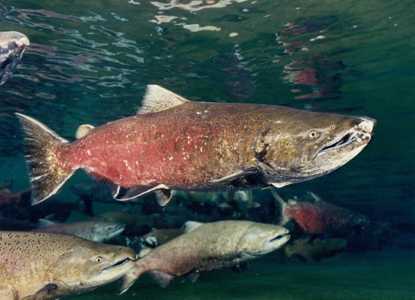
- The Hanford Reach supports the largest run of spawning fall Chinook salmon remaining in the Pacific Northwest.
- The Department of Energy began conducting aerial surveys to identify and count salmon redds in the Hanford Reach in 1948.
- EAS staff members have participated in monitoring redd abundance and distribution in the Hanford Reach since the 1970s. Currently, we work with MSA to monitor relative abundance among spawning areas and years and document the onset of spawning, locate spawning areas, and determine intervals of peak spawning activity.
- Since 2011, the EAS team has conducted aerial surveys of fall Chinook salmon redds in eleven areas of the Hanford Reach consistent with past survey efforts and the historical database.
- In 2011, the Department of Energy added eight new sections of the river to better monitor the abundance and distribution of fall Chinook redds in areas of potential upwelling of contaminated groundwater.
- In 2011, the field team identified a total 8,915 salmon redds, 2,533 located in areas identified as potential sites of groundwater upwelling.
- A total of 8,368 redds were counted in 2012 surveys, 2,012 in areas directly adjacent to Hanford Site operations.
- In 2013, EAS conducted aerial surveys the entire length of the Hanford Reach, from Priest Rapids Dam downstream to the I-82 bridge.
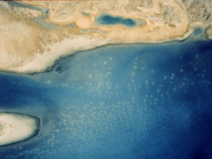
- In conjunction with visual surveys, the survey team took vertical aerial photographs to compare counts between visual estimates and photographs.
- In 2013, the peak annual visual redd count was 17,398, almost double the number counted in 2012 and exceeding the all-time high of 9,465. With the addition of aerial photographs, we estimated a total of 26,193 Chinook salmon redds in the Hanford Reach.
- To ensure compatibility and consistency with past survey efforts and the ongoing Hanford Reach Fall Chinook Protection Program, EAS thoroughly reviewed and adopted past monitoring protocols, coordinated/trained with former redd count personnel, and coordinated and exchanged information with the Washington Department of Fish and Wildlife and the Grant County Public Utility District.
- EAS also used maps detailing the entire survey reach as well as all historical sub-areas and spawning sites both as in-flight guidance documents and field data recording forms. We relied on the same air service, airplane, and pilots used in previous years.