Map Aquatic Invasive Plants In The Rocky Reach Hydroelectric Project Area-Upper Columbia River
Chelan County Public Utility District awarded EAS a contract to map aquatic invasive plants at and near the Rocky Reach hydroelectric project. EAS will conduct field surveys and monitoring in the upper Columbia River to support Chelan PUD compliance with federal, state, and regional laws and agreements that protect and enhance fisheries in the Federal Columbia River Power System. These include the Federal Energy Regulatory Commission License, U.S. Fish and Wildlife Service Biological Opinion, and the Clean Water Act Section 401 Water Quality Certification issued by the Washington Department of Ecology.
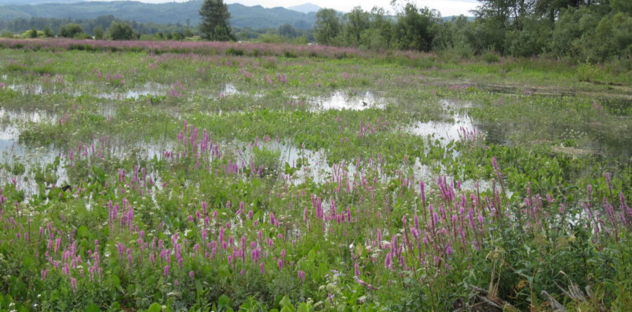
To assist the Chelan PUD meet FERC and Ecology requirements related to 401 Water Quality Conditions, EAS monitored the project area for all aquatic invasive plants listed on the Washington State Noxious Weed List. Beginning in August 2016, EAS worked closely with Chelan PUD biologists to re-map 46 known weed beds (~406 acres total throughout the project area) as part of the project’s Aquatic Invasive Species Monitoring and Control Plan. Scientists will identify newly introduced aquatic invasive species and map and track their movements as well as those of existing invasive plants.
Specific objectives for this effort were to provide Chelan PUD 1) updated GIS shape files of the weed bed polygons mapped during late summer/fall season, and 2) a summary of dominant and subdominant species composition of the 46 sampled weed beds. Information gained from this project will assist Chelan PUD meet requirements to monitor for the presence of new invasive species at or near project facilities.